Tag Archives: resolution

TinEye – a revolutionary image search engine

There’s no doubt about it, TinEye is a great find for image use:

TinEye is a reverse image search engine. It finds out where an image came from, how it is being used, if modified versions of the image exist, or if there is a higher resolution version.

TinEye claims to be responsible for ‘changing the face of media search’. It claims to do for images what Google does for text. I don’t know about you but I’ve been waiting for something like this for ages.  Now you can locate your image on websites all over the internet.

Searching your image:

Instead of searching by keyword, you either upload an image from your computer or provide a link to that image. It only takes a few seconds for the results to appear. The first images listed are the ones which are the closest match to the searched image. As you go further down the list, you find edited images – interesting in itself.

You can compare any of the matched images to your image by clicking compare and then switch. In some cases it’s a colour/tone difference or else the image has been modified. The link under the image will take you to the page of the result. It’s great if you are looking for a different size, eg  a better resolution.

There is an option to share the image via Twitter, Facebook, email or an extensive list of other ways. I’m so spoiled with sharing options that when I’m unable to share easily I get really frustrated.

With TinEye you can sort the order of your search by:

  • best match
  • most changed
  • biggest image.

You can also install browser plugins if you like.

If you register with TinEye you can contribute to the forum. I have a feeling this site will be growing, and I wonder how many copy-cat sites will be created now.

Have a play! I’m going to think about educational possibilities using the TinEye image search. As always the technology opens up to options powered by human imagination and innovation.


Super Google Earth and Maps


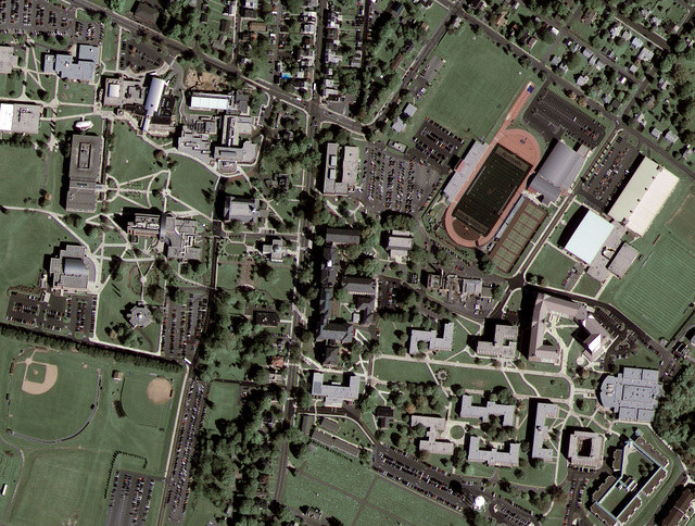
Google Maps and Google Earth have astounded us all with new possibilities in viewing the world, connecting our photos and stories to real locations. But, as the Read Write Web has pointed out, many of the top-down images have been unclear so far. All this is about to change as Google connects with GeoEye-1 to produce high-resolution images. Wired Science has posted the first Google/GeoEye image. Compare the new image to the one without GeoEye-1’s superior resolution.

Here’s some information on GeoEye-1:

GeoEye-1 is equipped with the most sophisticated technology ever used in a commercial satellite system. It offers unprecedented spatial resolution by simultaneously acquiring 0.41-meter panchromatic and 1.65-meter multispectral imagery. The detail and geospatial accuracy of GeoEye-1 imagery further expands applications for satellite imagery in every commercial and government market sector. To learn more about GeoEye’s collection and delivery capabilities, please visit our launch site.

Google is GeoEye-1’s second major partner after the National Geospatial-Intelligence Agency, a U.S. government agency that analyzes imagery in support of national security. The NGA will be retrieving GeoEye-1’s imagery at the maximum resolution of 43 centimetres, but government restrictions will limit Google’s images to a 50 centimetre resolution. Thanks to an exclusive partnership, Google will be the only online mapping site using GeoEye-1’s satellite photos.

As far as education goes, we’ve come a long, long way from the boring geography lessons, trying to connect the pale, coloured maps in our textbooks with real locations, mustering up enthusiasm for places we could only appreciate in fertile imaginations.

I’m happy to take advantage of Google Maps’ and Google Earth’s new and improved visual mapping – as long as they don’t come any closer to me.