Tag Archives: Google Earth

Go underwater with Google Earth 5.0

Google Earth 5.0 has 2 new features. The first allows you to go back in time. You can go back in time to compare historical imagery of buildings, and you can compare historical photos of environmental features. observing changes to the landscape of our planet. The former will be of interest to history teachers, and the latter  to science teachers who will be able to use Google Earth to show students how climate change is affecting the Earth’s surface. What better way of learning than seeing for yourself.

This new application opens up exciting possibilities. When you click on the clock icon in the Google Earth 5.0 toolbar, the historical imagery time slider will appear and allow you to change your view to older imagery.

The Google Earth site includes a video which gives one of the examples of historic imagery, showing the  transformation of sports arenas in Philadelphia.

[youtube=http://www.youtube.com/watch?v=acKMplVeY6A&eurl=http://google-latlong.blogspot.com/&feature=player_embedded]


The Google Earth blog explains its exploration underwater:

But starting today we have a much more detailed bathymetric map (the ocean floor), so you can actually drop below the surface and explore the nooks and crannies of the seafloor in 3D. While you’re there you can explore thousands of data points including videos and images of ocean life, details on the best surf spots, logs of real ocean expeditions, and much more.

Prado in Google – a closer look at art

[youtube=http://au.youtube.com/watch?v=D1EOJr11bvo]

Viewing a Velasquez or a Rembrandt in a place like Spain’s Prado museum is a unique experience. Now you can use Google Earth technology to navigate reproductions of the Prado’s masterpieces, delving even deeper into the Prado’s collection. In Google Earth, you can get close enough to examine a painter’s brushstrokes or the craquelure on the varnish of a painting. The images of these works are about 14,000 million pixels, 1,400 times more detailled than the image a 10 megapixel digital camera would take. In addition, you’ll be able to see a spectacular 3D reproduction of the museum.

You can have this exquisite experience in Google Maps. There are 3 paintings you can currently view here, with a new painting a day after that for the next two weeks. I zoomed into Bosch’s ‘The garden of earthly delights’ and saw some very strange things happening in detail.

If you visit the Prado museum in Spain through Google Earth like I did, you’ll be able to view paintings in high resolution, as I did when I clicked on Goya’s ‘The 3rd of may’.  Here’s what it says once you get there:

We present a virtual tour of fourteen masterpieces from the Museo Nacional del Prado, displayed in ultra high resolution, enabling you to see details of the paintings that have never been seen before. Thanks to the high resolution of the digital images, you can view the whole painting or zoom in on a small fragment. Given the plethora of masterpieces housed at the Museum, choosing which works to include was no easy task but this selection represents the best of the collection.

What a way to learn; you can zoom into these works of art from wherever you are.

Jonathan Jones has a great art blog on guardian.co.uk has an interesting post with the pros and cons of this virtual art gallery.

I’ll get off now so you can get on with the virtual trip.  Have fun.

early images of reality from picture books and today’s clickability

We take for granted today the clickability of information. We should think back, really think back properly, to the days before we had the internet as a source of information.

I was talking to my son today about our early conceptions, and we shocked ourselves about uninformed and xenophobic ideas we had of people and cultures when we were children. My primary school years situated me in a very narrow place, although not as narrow as some, since I did come from an ethnic background. These are very interesting times because we are developing and learning like crazy but we don’t have a great deal as points of reference, so our learning is coloured by our often incomplete or erroneously formed concepts. To put it another way, what information we do gather is not always correctly understood and is even reconstructed by our own imagination. I say imagination because you need a great deal of it to fill in the gaps between the isolated pockets of knowledge and understanding.

So, I remember growing up with Australians who were either ‘real Australians’ or from a European background (Greeks, Italians, Macedonians) and Russians from my own cultural group which was always a minority (and none at school). Since I loved to read, my knowledge in these days was gleaned from books, most of which I owned and some from libraries. Information books didn’t seem to abound, and picture books were often teachers of the world beyond my own. I remember learning about dark-coloured people with grass skirts or slanty-eyed people, people living in teepees or igloos or swimming underwater every day. Now, that’s not a deliberately racist description because, since my information was delivered through a visual medium, my knowledge of these people was almost entirely visual. And not a realistic depiction but usually a cutesy illustration.

Now we take it for granted, but a little context to information is just a click away on the internet. Google Earth or Maps would have given my little snippets of information of other cultures a geographical location, and joined all those floating, isolated bits of knowledge into a world map; Flickr could have given me an easily accessible collection of pictures. Of course, information books with photos abound, even picture books with beautiful photography which deliver early aspects of reality to the preschool child.

How has this affected my development of knowledge? Do I still harbour distorted ideas of the way things are in the depths of my subconsious? Or have I worked hard at reconstructing and revising the way I see and understand things? Is this a blessing in disguise, a constant practice for maintaining elasticity and flexibility in the course of life and my understanding of it?

Meanwhile, I remember my picture book worlds with nostalgia. I used to imagine myself in the pictures, and dreamed of living on the little island where the smiling grass-skirt girls lived, so tiny that you could walk it in a couple of minutes, always sunny, water crystal clear, fish and birds abounding, all things provided for idyllic living. Did you wish you lived in any of your picture books?

Super Google Earth and Maps


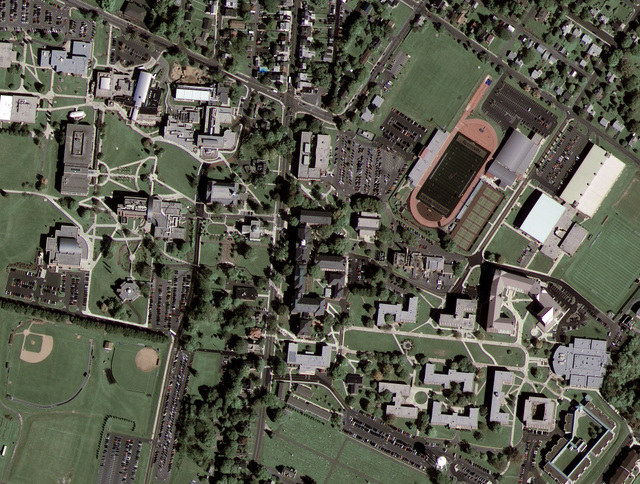
Google Maps and Google Earth have astounded us all with new possibilities in viewing the world, connecting our photos and stories to real locations. But, as the Read Write Web has pointed out, many of the top-down images have been unclear so far. All this is about to change as Google connects with GeoEye-1 to produce high-resolution images. Wired Science has posted the first Google/GeoEye image. Compare the new image to the one without GeoEye-1’s superior resolution.

Here’s some information on GeoEye-1:

GeoEye-1 is equipped with the most sophisticated technology ever used in a commercial satellite system. It offers unprecedented spatial resolution by simultaneously acquiring 0.41-meter panchromatic and 1.65-meter multispectral imagery. The detail and geospatial accuracy of GeoEye-1 imagery further expands applications for satellite imagery in every commercial and government market sector. To learn more about GeoEye’s collection and delivery capabilities, please visit our launch site.

Google is GeoEye-1’s second major partner after the National Geospatial-Intelligence Agency, a U.S. government agency that analyzes imagery in support of national security. The NGA will be retrieving GeoEye-1’s imagery at the maximum resolution of 43 centimetres, but government restrictions will limit Google’s images to a 50 centimetre resolution. Thanks to an exclusive partnership, Google will be the only online mapping site using GeoEye-1’s satellite photos.

As far as education goes, we’ve come a long, long way from the boring geography lessons, trying to connect the pale, coloured maps in our textbooks with real locations, mustering up enthusiasm for places we could only appreciate in fertile imaginations.

I’m happy to take advantage of Google Maps’ and Google Earth’s new and improved visual mapping – as long as they don’t come any closer to me.

Geography2.0

[youtube=http://www.youtube.com/watch?v=O0SnaK4T7qU&color1=11645361&color2=13619151&fs=1]

About.com:Geography is a site worth checking out to support learning about current events in SOSE. Make learning relevant by focussing on what’s in the media now. You’ll find information about countries that are in the news, for example, the war in Georgia, countries in the Olympic Games, Olympic Games cities 1896-2014, geography and maps of China, photo gallery of Beijing. It might be worth signing up for a geography newsletter, or bookmarking Matt’s geography blog (which has an impressive geography blogroll).

The Google Earth blog has an interesting selection of post. Have a look at how Google Earth and Google Maps bring events and geography to life; watch Arctic ice melting on YouTube in Google Earth. So many Web2.0 geography opportunties!

Here is a video fly-through of the 3D Olympic Games site in Beijing that Google has released:

[youtube=http://www.youtube.com/watch?v=0p2cEQCsBuY&color1=11645361&color2=13619151&hl=en&fs=1]